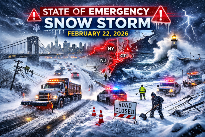
On February 22, 2026, a major winter storm moving up the U.S. East Coast prompted multiple emergency declarations and widespread blizzard warnings across parts of the Mid-Atlantic and New England. Forecasters warned that the combination of heavy snowfall, high winds, and coastal impacts could make travel extremely dangerous and disrupt power, roads, and transportation networks.
This article explains what officials and forecasters were saying on February 22, 2026, what a “state of emergency” typically changes in real life, why the storm drew an aggressive public response, and what to watch as conditions evolve.
What forecasters expected on February 22, 2026
Meteorologists described the setup as a high-impact nor’easter capable of producing blizzard conditions in a broad corridor from the Mid-Atlantic into southern New England.
Key threats emphasized in public messaging included:
- Heavy snowfall, potentially reaching 1–2 feet in some areas
- Strong winds that could create whiteout conditions
- Rapidly deteriorating travel conditions, especially overnight into February 23
- Power outage risk where snow load and wind stress trees and lines
- Coastal flooding risks in exposed shoreline areas
A recurring theme was that the worst conditions were expected to intensify overnight, when visibility and travel safety can deteriorate faster than people expect.
Why “blizzard warning” is different from “big snow”
A blizzard warning is not only about how many inches of snow fall.
Blizzard criteria typically focuses on:
- Very low visibility (often 1/4 mile or less)
- Strong sustained winds and/or frequent gusts
- Conditions persisting for several hours (commonly at least three)
This is why officials stress travel risk even when snowfall totals can vary sharply across neighborhoods. Wind can turn moderate accumulation into dangerous whiteouts, especially on open roads, bridges, and coastal corridors.
Where emergency declarations were issued on February 22, 2026
Emergency declarations were made at multiple levels of government as forecasts sharpened and impacts became more likely.
Below are the most prominent declarations and restrictions reported on February 22, 2026.
New York State
New York State declared a state of emergency covering numerous counties, including areas in and around New York City and Long Island.
Public guidance highlighted:
- Potential for very heavy snow in the metro region
- Strong wind gusts capable of producing whiteouts
- Pre-staging of resources, including readiness measures with utilities and emergency personnel
The operational goal was to accelerate coordination and response while conditions were still manageable.
New York City
New York City declared a local state of emergency and announced a temporary travel restriction aimed at keeping non-essential vehicles off roads during peak storm conditions.
The city also indicated:
- A snow day closure for public schools on February 23 (with some buildings used as warming centers)
- Adjustments to parking and enforcement practices during the storm window
- Attention to emergency consumer protections such as price gouging enforcement
The intent was to reduce accidents, keep streets clearer for plows, and preserve movement for emergency vehicles.
New Jersey
New Jersey announced a state of emergency effective midday on February 22, referencing:
- Expected blizzard conditions
- Heavy snow and strong winds
- Possible coastal flooding
Statewide declarations often prioritize mobility: keeping major routes clear for plowing and emergency response.
Connecticut
Connecticut declared a state of emergency and paired it with a targeted transportation restriction:
- A prohibition on certain commercial vehicle travel on limited access highways beginning later on February 22
These restrictions are typically designed to:
- Reduce jackknifes and multi-vehicle crashes
- Prevent large vehicles from blocking plows and emergency response
- Keep key routes usable for restoration and rescue operations
Delaware
Delaware also issued a state of emergency effective midday on February 22.
The announcement emphasized:
- Mobilization of statewide resources
- Activation readiness through emergency management structures
- Preparation for widespread disruptions if blizzard conditions became severe
What a “state of emergency” usually changes (and what it doesn’t)
The phrase “state of emergency” can sound dramatic, but it is often a practical administrative tool. The details vary by jurisdiction, but common effects include:
What it enables
Faster purchasing and contracting
Governments can often buy salt, fuel, equipment, and services faster than under normal rules.
Faster resource deployment
Emergency declarations can accelerate:
- Personnel staging
- Mutual aid coordination
- Emergency operations center activation
- National Guard support in some scenarios
Road and travel restrictions
These may include:
- Limits on non-essential travel
- Commercial vehicle restrictions
- Temporary closures of high-risk routes
Stronger enforcement actions
Some declarations explicitly support:
- Anti–price gouging measures
- Temporary rules around parking, towing, or public access
What it does not mean
- It does not guarantee the same severity in every neighborhood
- It does not prove a forecast is “certain”
- It does not automatically mean evacuation or curfews (unless specifically announced)
- It does not prevent debate about costs versus risk
In most cases, the declaration is about flexibility and speed—doing more, sooner, with fewer procedural delays.
Why so many declarations at once
Broad emergency declarations usually reflect a storm’s overall risk profile—not just snowfall totals.
Common drivers include:
1) Dense population and infrastructure
When a storm targets major metro areas, impacts multiply:
- airports and rail hubs
- highways and bridges
- interconnected commuting corridors
- high demand on emergency services
2) Wind-driven danger
Wind is often what turns “bad weather” into “don’t travel” conditions.
Strong gusts can create:
- whiteouts even after plows have passed
- drifting that re-buries cleared roads
- falling branches and downed lines
3) Coastal flooding layered on top of snow
Nor’easters frequently combine inland snow with shoreline hazards.
This forces planners to prepare for:
- coastal road closures
- surge-driven flooding near high tide
- water-related rescues and power disruptions
4) Local uncertainty
Even when confidence is high in a major storm, the exact placement of the heaviest snow bands can shift.
Officials often act early because the downside risk of under-preparation is severe.
Transportation impacts: roads, transit, and flights
Transportation disruptions are often the first widely visible impacts.
Roads and driving risk
Key hazards include:
- low visibility and whiteouts
- slick surfaces combined with strong crosswinds
- stalled vehicles blocking plows
- multi-vehicle crashes that trap people for hours
That is why many jurisdictions prioritize reducing non-essential travel during peak intensity.
Public transit
Transit systems can be affected by:
- reduced service due to staffing and safety limits
- snow and ice affecting above-ground lines
- wind-related restrictions on bridges and exposed corridors
Agencies often reduce schedules first, then suspend routes if conditions worsen.
Flights and airports
Air travel often sees early disruptions because airlines and airports preemptively cancel flights to avoid stranding aircraft and passengers.
In storms affecting the Northeast corridor, cancellations can cascade nationwide because many routes connect through a few key hubs.
Power and utilities: why outages become likely
Power outage risk increases when:
- snow is heavy and sticks to branches and lines
- wind gusts shake already-loaded trees
- saturated ground makes roots less stable, increasing tree falls
Utilities often stage crews in advance so restoration can begin as soon as conditions allow safe movement.
During strong storms, restoration speed frequently depends on:
- road access
- duration of peak wind conditions
- whether outages are scattered or concentrated
Community impacts: schools, services, and vulnerable populations
When governments close schools and open warming centers, the decision is usually about transportation safety and heating reliability rather than one single snowfall number.
School closures
Factors include:
- bus route safety
- staff ability to commute
- timing of peak snowfall and wind
- neighborhood plowing priorities
Warming centers and emergency sheltering
Warming centers matter most for:
- people without reliable heat
- residents experiencing prolonged outages
- older adults or medically vulnerable individuals
Storm planning frequently includes public messaging encouraging people to check on neighbors and family members.
Preparedness messaging: what officials typically emphasize
Emergency messaging tends to center on reducing preventable harm.
Common recommendations
- Avoid non-essential travel during peak conditions
- Prepare for short-duration outages (charging devices, flashlights, basic supplies)
- Keep prescriptions and essential items accessible
- Follow local safety guidance for heat and power outages
- Use official alerts for road restrictions and service updates
Even small choices—like avoiding a short drive—can reduce the burden on emergency responders and plow operations.
Canada’s Atlantic coastline: related coastal impacts
While the most visible emergency declarations on February 22, 2026 were in U.S. jurisdictions, large North Atlantic storm systems often bring secondary impacts into Atlantic Canada—particularly around coastal flooding and wave hazards.
These events can show up as:
- elevated water levels
- strong onshore winds
- damaging surf during high tides
The exact impact depends on the storm track and timing relative to tidal cycles.
Keeping an unbiased view during an active emergency
Storm coverage can feel intense because it blends forecasts, precautionary policy decisions, and early impacts—sometimes before the “worst” arrives.
A neutral assessment keeps several realities in view:
Forecasts are probabilistic
Even high-confidence storms have local variability.
Officials manage risk in real time
Emergency decisions are made before the outcome is fully known.
Disruptions have real costs
Closures and restrictions affect workers, businesses, and services—so scrutiny is normal.
Under-preparation can be catastrophic
The reason officials act early is that the worst-case outcomes—whiteout crashes, stranded motorists, widespread outages—are hard to recover from quickly.
Unbiased reporting acknowledges both sides: the public inconvenience and the safety rationale.
What to watch next after February 22, 2026
As the storm moves forward, the most meaningful indicators tend to be observational, not speculative.
High-value signals
Snowband placement and intensity
Where the heaviest bands sit often determines who sees the largest totals.
Wind observations
Wind speed and gust frequency can determine whether true blizzard conditions occur.
Outage patterns
Outage clustering reveals where wet snow and wind are combining most severely.
Coastal flooding at high tide
Some of the most damaging coastal impacts align with tide cycles.
Policy updates
Travel restrictions and emergency orders can tighten or relax quickly based on conditions.
Summary
On February 22, 2026, multiple states and cities used emergency declarations and travel restrictions to prepare for a high-risk winter storm forecast to bring heavy snow, strong winds, and potential coastal impacts across parts of the U.S. Northeast. While the exact totals and timing can vary locally, the combination of wind-driven low visibility, travel hazards, outage potential, and coastal complications explains why officials responded early and broadly.


